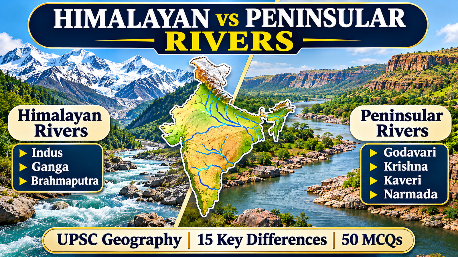
The Indian drainage system is one of the most important topics in Indian Geography for UPSC Civil Services Examination, State PCS, SSC and other competitive examinations. India’s rivers play a significant role in agriculture, irrigation, hydroelectricity, transportation, industries, biodiversity and the overall development of the country.
The Himalayan Rivers vs Peninsular Rivers UPSC topic is particularly important because questions are frequently asked about their origin, source of water, drainage patterns, tributaries, river valleys, deltas, estuaries and geographical characteristics.
The Indian drainage system is broadly divided into two major river systems:
- Himalayan River System
- Peninsular River System
Although both systems are essential to India’s geography, they differ significantly in their geological origin, nature of flow, length, drainage patterns and landforms.
The Himalayan rivers generally originate in or beyond the Himalayan mountain ranges and receive water from rainfall, snowmelt and glaciers. In contrast, the Peninsular rivers mainly originate in the Peninsular Plateau and are largely dependent on monsoon rainfall.
In this comprehensive guide, we will understand the difference between Himalayan and Peninsular rivers through detailed explanations, comparison tables, examples, important geographical facts and 50 practice MCQs for UPSC Prelims.
For effective UPSC Prelims preparation, strengthen your knowledge of India’s river systems by practising 100 Powerful Himalayan Peninsular Rivers MCQs for UPSC: Master Your Prelims!, featuring important questions with answers and brief explanations.

What Are Himalayan Rivers?
Himalayan rivers are the major river systems that originate in the Himalayas or adjoining high-altitude regions. These rivers drain extensive parts of northern and northeastern India.
The three major Himalayan river systems are:
- Indus River System
- Ganga River System
- Brahmaputra River System
These rivers are generally perennial because they receive water from both rainfall and melting snow and glaciers. However, their discharge is not constant throughout the year. It varies with monsoon rainfall, snowmelt and seasonal conditions.
For a better understanding of regional river systems and geographical features, candidates should also study Uttar Pradesh Geography for UPPCS, which covers the state’s physical geography, rivers, climate, soil and other important topics.
Main Characteristics of Himalayan Rivers
1. Perennial Nature
Himalayan rivers generally flow throughout the year because they receive water from rainfall as well as snow and glacier melt. This is why they are commonly described as perennial rivers.
2. Long Courses
Many Himalayan rivers travel long distances from their mountainous origins to the plains and eventually reach the Arabian Sea or Bay of Bengal.
3. Large Drainage Basins
The Himalayan river systems have extensive drainage basins covering large geographical areas.
4. Deep Gorges in Mountainous Regions
In their upper courses, several Himalayan rivers cut deep gorges through mountain ranges. These features are associated with strong erosion and, in some cases, antecedent drainage.
5. Meanders and Floodplains
After entering the northern plains, Himalayan rivers generally develop meanders, broad floodplains, natural levees and oxbow lakes.
6. Heavy Sediment Load
These rivers carry substantial quantities of sediments eroded from the Himalayas. The sediments are deposited in the plains and contribute to the formation of fertile alluvial soil.
7. Frequent Changes in Channels
Some Himalayan rivers, particularly the Brahmaputra, are known for braided channels and changes in their courses due to sediment deposition, erosion and floods.
The topic Himalayan Rivers vs Peninsular Rivers UPSC is important for understanding India’s drainage system, river characteristics, geographical differences and major water resources. A clear comparison of these two river systems helps aspirants prepare effectively for UPSC Prelims and Geography-related Mains questions.

Major Himalayan Rivers and Their Tributaries
The Himalayan River System of India consists mainly of the Indus, Ganga and Brahmaputra systems.
Indus River System
The Indus is one of the major rivers of the Indian subcontinent. It originates in the Tibetan Plateau near the region of Lake Manasarovar and flows northwest through the Himalayan and trans-Himalayan region before entering Pakistan.
Important tributaries include:
- Jhelum
- Chenab
- Ravi
- Beas
- Sutlej
The Indus River System is important for irrigation, agriculture and water resources in the northwestern part of the Indian subcontinent.
While studying Himalayan Rivers vs Peninsular Rivers UPSC, it is important to understand that Himalayan rivers generally receive water from rainfall, snowmelt and glaciers, making them largely perennial in nature.
Ganga River System
The Ganga is one of India’s most important rivers, both geographically and culturally.
The Bhagirathi originates from the Gangotri Glacier region in Uttarakhand. The Alaknanda and Bhagirathi meet at Devprayag, where the combined river is known as the Ganga.
Important tributaries of the Ganga include:
- Yamuna
- Ramganga
- Gomti
- Ghaghara
- Gandak
- Kosi
- Son
The Ganga basin covers a vast area and supports agriculture, industries, cities and millions of people.
Brahmaputra River System
The Brahmaputra originates in the Tibetan region, where it is known as the Yarlung Tsangpo.
It flows eastward across Tibet, takes a sharp turn around the eastern Himalayan region and enters Arunachal Pradesh as the Siang or Dihang.
After receiving major tributaries such as the Dibang and Lohit, it flows through Assam as the Brahmaputra.
Important characteristics include:
- Large water discharge
- High sediment load
- Braided river channels
- Extensive floodplains
- Frequent floods in Assam
The Brahmaputra is particularly important for understanding the drainage system of northeastern India.
To understand the river systems of northern India in greater detail, explore our dedicated guide on Important Rivers of Uttar Pradesh, featuring major rivers, tributaries, river maps and important geographical facts.

What Are Peninsular Rivers?
Peninsular rivers originate mainly in the Peninsular Plateau of India. Their drainage basins are generally older and more geologically stable than the Himalayan river systems.
Most Peninsular rivers depend heavily on monsoon rainfall. Therefore, their water discharge usually increases during the rainy season and decreases during the dry season.
However, some Peninsular rivers maintain substantial flow through the year because of their large catchments, reservoir regulation and regional rainfall conditions. Therefore, it is not correct to assume that every Peninsular river completely dries up during the summer.
In the Himalayan Rivers vs Peninsular Rivers UPSC comparison, Peninsular rivers are distinguished by their dependence on monsoon rainfall, relatively stable courses and drainage through the ancient Peninsular Plateau.
Main Characteristics of Peninsular Rivers
1. Mainly Rain-Fed
Most Peninsular rivers depend primarily on monsoon rainfall rather than glacier melt.
2. Relatively Fixed Courses
These rivers generally flow through older and more stable geological formations. Their courses are comparatively well established.
3. Smaller Drainage Basins
Compared with the major Himalayan river systems, many Peninsular rivers have smaller drainage basins and shorter courses.
4. Mature River Valleys
Peninsular rivers generally flow through broad valleys and relatively stable landscapes.
5. Seasonal Variation in Water Flow
Their discharge often fluctuates considerably between the monsoon and dry seasons.
6. Waterfalls and Rapids
The plateau region contains steep gradients and rocky terrain in several locations, resulting in waterfalls and rapids.
7. Eastward and Westward Drainage
Most major Peninsular rivers flow eastward towards the Bay of Bengal. Important exceptions include the Narmada and Tapi, which flow westward towards the Arabian Sea.
Major Peninsular Rivers of India
The major Peninsular rivers include the Godavari, Krishna, Kaveri, Mahanadi, Narmada and Tapi.
Godavari River
The Godavari is the longest river of Peninsular India and is often called the Dakshin Ganga.
- Origin: Trimbakeshwar near Nashik, Maharashtra
- Approximate length: 1,465 km
- Direction: Mainly eastward
- Mouth: Bay of Bengal
Important tributaries include the Pravara, Purna, Manjira, Pranhita, Indravati and Sabari.
Krishna River
The Krishna is one of the major east-flowing rivers of Peninsular India.
- Origin: Near Mahabaleshwar, Maharashtra
- Approximate length: 1,400 km
- Direction: Eastward
- Mouth: Bay of Bengal
Important tributaries include the Bhima, Tungabhadra, Ghataprabha and Malaprabha.
Kaveri River
The Kaveri is an important river of southern India.
- Origin: Talakaveri in the Brahmagiri Hills, Karnataka
- Approximate length: 800 km
- Direction: Generally southeastward
- Mouth: Bay of Bengal
Important tributaries include the Hemavati, Kabini, Bhavani and Amaravati.
Mahanadi River
The Mahanadi is an important east-flowing river of central and eastern India.
- Origin: Chhattisgarh
- Approximate length: 851 km
- Direction: Eastward
- Mouth: Bay of Bengal
It forms an extensive delta near its mouth in Odisha.
Narmada River
The Narmada is one of the most important west-flowing rivers of India.
- Origin: Amarkantak Plateau, Madhya Pradesh
- Approximate length: 1,312 km
- Direction: Westward
- Mouth: Arabian Sea
It flows through a rift valley between the Vindhya Range to the north and the Satpura Range to the south.
Tapi River
The Tapi, also known as the Tapti, is another important west-flowing Peninsular river.
- Origin: Multai in the Satpura Range, Madhya Pradesh
- Approximate length: 724 km
- Direction: Westward
- Mouth: Arabian Sea
It flows through a rift valley and drains into the Arabian Sea.
The following Himalayan Rivers vs Peninsular Rivers UPSC comparison table highlights 15 major geographical differences based on origin, water sources, drainage basins, river valleys, sediment load and river mouths.
Himalayan Rivers vs Peninsular Rivers: 15 Major Differences
Understanding the difference between Himalayan and Peninsular rivers is essential for UPSC Prelims and Mains.
The following comparison table covers 15 important differences.
| Basis of Comparison | Himalayan Rivers | Peninsular Rivers |
|---|---|---|
| 1. Origin | Himalayas and adjoining high-altitude regions | Peninsular Plateau and surrounding highlands |
| 2. Geological Age | Generally associated with younger Himalayan mountain-building regions | Associated with the ancient Peninsular landmass |
| 3. Nature of Flow | Generally perennial | Mostly seasonal, with considerable variation |
| 4. Source of Water | Rainfall, snowmelt and glaciers | Mainly monsoon rainfall |
| 5. Length | Major systems generally have long courses | Generally shorter courses |
| 6. Drainage Basin | Extensive drainage basins | Comparatively smaller drainage basins |
| 7. Valley Shape | Deep gorges in mountains and broad floodplains downstream | Generally broad and mature valleys |
| 8. Erosion | Strong erosion in mountainous upper courses | Erosion varies with terrain and gradient |
| 9. Sediment Load | Generally high sediment load | Generally lower sediment load in comparison |
| 10. Course Stability | Some rivers show channel shifts and braided patterns | Courses are comparatively stable |
| 11. Meanders | Extensive meanders in plains | Meandering occurs, but varies by river and terrain |
| 12. Waterfalls | Found in mountainous stretches | Common in plateau regions |
| 13. Drainage Pattern | Dendritic, trellis and other patterns occur | Dendritic, radial and other patterns occur |
| 14. River Mouth | Ganga-Brahmaputra system forms a major delta; Indus forms a delta | Most major east-flowing rivers form deltas; Narmada and Tapi form estuarine mouths |
| 15. Examples | Indus, Ganga and Brahmaputra | Godavari, Krishna, Kaveri, Mahanadi, Narmada and Tapi |
Important UPSC Note: These are broad geographical generalisations. Individual rivers may show exceptions, and their characteristics vary along different stretches of their courses.
Perennial vs Seasonal Rivers in India
One of the most frequently asked questions is: Why are Himalayan rivers perennial while Peninsular rivers are seasonal?
The main reason is the difference in their sources of water.
Why Are Himalayan Rivers Perennial?
Himalayan rivers receive water from multiple sources:
- Rainfall during the monsoon
- Snowmelt during warmer months
- Glacier melt
- Groundwater contribution
Because they receive water from both rainfall and melting snow and glaciers, many Himalayan rivers continue to flow throughout the year.
However, their discharge is not uniform. Flooding and high water levels are common during the monsoon season.
Why Are Peninsular Rivers Mostly Seasonal?
Most Peninsular rivers depend heavily on monsoon rainfall.
During the southwest monsoon, they receive substantial water and their discharge increases. During the dry months, their water levels generally decline.
Their flow characteristics depend on:
- Rainfall distribution
- Catchment area
- Soil and rock structure
- Groundwater contribution
- Reservoirs and dams
Therefore, Peninsular rivers are generally described as seasonal or monsoon-dependent rivers.
An important aspect of Himalayan Rivers vs Peninsular Rivers UPSC is the difference between perennial and seasonal river flow, which is mainly determined by their sources of water.
Why Do Most Peninsular Rivers Flow from West to East?
An important geographical feature of the Peninsular Plateau is its general eastward slope.
Due to this regional slope, most major Peninsular rivers flow from west to east and drain into the Bay of Bengal.
Examples include:
- Godavari
- Krishna
- Kaveri
- Mahanadi
These rivers generally form deltas near their mouths because of sediment deposition along the eastern coast.
Why Do Narmada and Tapi Rivers Flow Westward?
The Narmada and Tapi are major exceptions to the general eastward drainage pattern.
Both rivers flow westward through rift valleys and drain into the Arabian Sea.
The Narmada flows between the Vindhya and Satpura ranges, while the Tapi flows through a valley south of the Satpura Range.
Their westward flow is closely associated with the geological structure and regional relief of the area.
Delta vs Estuary: Important Differences
The Himalayan Rivers vs Peninsular Rivers UPSC topic also covers the formation of deltas and estuaries, which helps explain the differences between the eastern and western drainage systems of India.
Another important topic in Indian drainage geography is the difference between deltas and estuaries.
What Is a Delta?
A delta is a depositional landform formed near the mouth of a river when sediments accumulate as the river enters a sea, ocean or other standing water body.
Many east-flowing Peninsular rivers form deltas along the Bay of Bengal.
Examples:
- Godavari Delta
- Krishna Delta
- Kaveri Delta
- Mahanadi Delta
The Ganga-Brahmaputra Delta is one of the world’s largest delta systems.
What Is an Estuary?
An estuary is a tidal river mouth where freshwater mixes with seawater. Estuaries are generally funnel-shaped and may have strong tidal influence.
The Narmada and Tapi form estuarine mouths on the western coast.

Delta vs Estuary Comparison Table
| Feature | Delta | Estuary |
|---|---|---|
| Formation | Mainly sediment deposition | Tidal influence and river-sea interaction |
| Shape | Often triangular or fan-shaped | Often funnel-shaped |
| Sediment Deposition | Generally high | Often less deposition at the mouth |
| River Channels | Frequently divided into distributaries | Usually a single main channel |
| Examples | Godavari, Krishna, Kaveri | Narmada, Tapi |
Comparison of Drainage Patterns
Drainage patterns describe the arrangement of river channels and their tributaries over a geographical area.
They are influenced by the slope of the land, geological structure, rock resistance and tectonic history.
Important drainage patterns include:
1. Dendritic Drainage Pattern
This pattern resembles the branches of a tree. It develops where rocks have relatively uniform resistance and there is no strong structural control.
2. Trellis Drainage Pattern
In this pattern, tributaries join the main river at approximately right angles. It commonly develops in regions with alternating bands of resistant and less-resistant rocks.
3. Radial Drainage Pattern
Rivers flow outward in different directions from a central elevated region.
4. Rectangular Drainage Pattern
This pattern develops where rivers follow joints and fractures in rocks, producing approximately right-angled bends.
Both Himalayan and Peninsular regions contain different drainage patterns. It would be incorrect to assign only one drainage pattern to either river system.
Importance of Himalayan and Peninsular Rivers
Both river systems are essential to India’s economy, ecology and human development.
Agricultural Importance
Himalayan rivers deposit fertile alluvial sediments across the northern plains. Their water supports extensive irrigation and agricultural activities.
Peninsular rivers also support agriculture through irrigation projects, dams, canals and reservoirs.
Hydroelectricity
Himalayan rivers have significant hydropower potential because of their steep gradients in mountainous regions.
Peninsular rivers also support hydroelectric power generation through multipurpose river valley projects.
Drinking Water and Industries
Both systems provide water for domestic consumption, industries and urban settlements.
Biodiversity and Ecosystems
Rivers support wetlands, aquatic ecosystems, fisheries and biodiversity. Their floodplains and deltas are also ecologically important.
Transportation and Navigation
Some river stretches support inland water transport. The navigability of a river depends on its depth, flow, channel conditions and infrastructure.
Floods and Water Management
Himalayan rivers can cause severe floods due to monsoon rainfall, snowmelt, sedimentation and changes in river channels.
Peninsular rivers also experience floods, particularly during periods of intense monsoon rainfall.
Therefore, integrated river basin management, flood forecasting, sustainable irrigation and pollution control are essential for both systems.
Along with Indian Geography, candidates preparing for State PCS examinations should also revise state-specific topics through our comprehensive UP Special GK for UPPCS 2026, covering important facts and essential topics related to Uttar Pradesh.
Important Facts for UPSC Prelims
For quick revision of Himalayan Rivers vs Peninsular Rivers UPSC, remember the following important geographical facts about major rivers, their tributaries, origins and drainage patterns.
Revise the following facts before attempting the MCQs:
- The Indian drainage system is broadly divided into Himalayan and Peninsular river systems.
- The three major Himalayan river systems are Indus, Ganga and Brahmaputra.
- The Ganga is formed at Devprayag by the confluence of Bhagirathi and Alaknanda.
- The Brahmaputra is known as Yarlung Tsangpo in Tibet.
- The Brahmaputra enters India through Arunachal Pradesh.
- The Godavari is the longest river of Peninsular India.
- The Godavari is also called Dakshin Ganga.
- The Narmada originates from the Amarkantak Plateau.
- The Tapi originates near Multai in Madhya Pradesh.
- Narmada and Tapi are important west-flowing Peninsular rivers.
- Most major east-flowing Peninsular rivers drain into the Bay of Bengal.
- The Ganga-Brahmaputra Delta is one of the world’s largest delta systems.
- The Narmada flows through a rift valley between the Vindhya and Satpura ranges.
- The Krishna originates near Mahabaleshwar in Maharashtra.
- The Kaveri originates at Talakaveri in Karnataka.
- The Mahanadi originates in Chhattisgarh.
- The Indus originates in the Tibetan Plateau near the Lake Manasarovar region.
- Himalayan rivers generally carry a high sediment load.
- Most Peninsular rivers depend heavily on monsoon rainfall.
- River discharge varies seasonally in both systems.
After revising the major geographical concepts, practise previous-year questions to understand the examination pattern. You can strengthen your preparation with our UPPCS Prelims PYQs: Most Important Guide 2026–27.
Frequently Asked Questions (FAQs)
1. What is the difference between Himalayan rivers and Peninsular rivers?
Himalayan rivers generally originate in the Himalayan region and receive water from rainfall, snowmelt and glaciers. Peninsular rivers mainly originate in the Peninsular Plateau and depend largely on monsoon rainfall.
2. Why are Himalayan rivers perennial while Peninsular rivers are seasonal?
Himalayan rivers receive water from rainfall as well as melting snow and glaciers. Most Peninsular rivers depend primarily on seasonal monsoon rainfall, so their discharge usually decreases during dry months.
3. What are the main characteristics of Himalayan rivers?
Their major characteristics include perennial flow, long courses, extensive drainage basins, deep gorges, meanders, fertile floodplains and high sediment loads.
4. What are the main characteristics of Peninsular rivers?
They generally have older and more stable courses, depend heavily on monsoon rainfall, flow through plateau regions and show considerable seasonal variation in discharge.
5. Which are the major Himalayan rivers of India?
The Indus, Ganga and Brahmaputra are the three major Himalayan river systems.
6. Which is the longest Peninsular river in India?
The Godavari is the longest river of Peninsular India, with an approximate length of 1,465 km.
7. Why do most Peninsular rivers flow from west to east?
The general slope of the Peninsular Plateau is towards the east, which directs most major rivers towards the Bay of Bengal.
8. Why do Narmada and Tapi rivers flow westward?
Their westward flow is associated with regional relief and rift valley structures that direct them towards the Arabian Sea.
9. Which rivers form deltas and estuaries in India?
Major east-flowing rivers such as the Godavari, Krishna, Kaveri and Mahanadi form deltas. The Narmada and Tapi form estuarine mouths on the western coast.
10. How are Himalayan and Peninsular drainage systems different in terms of origin, landforms and drainage patterns?
Himalayan drainage is associated with young mountain systems, deep gorges, extensive floodplains and large sediment loads. Peninsular drainage is associated with the ancient plateau, comparatively stable courses, waterfalls, mature valleys and a variety of structurally influenced drainage patterns.
For complete examination preparation, explore our UPPCS Prelims Ultimate Revision Guide, which brings together important revision resources and practice material for aspirants.
Conclusion
The Himalayan Rivers vs Peninsular Rivers comparison is an important part of Indian Geography for UPSC Prelims and Mains.
The Himalayan river system is generally characterised by perennial flow, extensive drainage basins, deep gorges, high sediment loads and large floodplains. In contrast, the Peninsular river system is associated with the ancient plateau, comparatively stable courses, monsoon-dependent flow and a combination of east-flowing and west-flowing rivers.
Understanding their origin, tributaries, drainage patterns, water sources and landforms will help aspirants build a strong foundation in Indian Physical Geography.
For effective UPSC preparation, revise the comparison table, practise map-based questions and attempt the 50 MCQs provided in this article.
A clear understanding of these two river systems will strengthen your conceptual knowledge and improve your ability to answer both factual and analytical questions in competitive examinations.
A thorough understanding of Himalayan Rivers vs Peninsular Rivers UPSC will help aspirants develop a strong conceptual foundation in Indian Geography and answer river-system questions more confidently.
Recommended Posts
Valuable October 2026 Sports Current Affairs MCQs for UPSC, PCS & SSC with Answers
100 Valuable September 2026 World Current Affairs MCQs for UPSC Prelims 2027
100 Important September 2026 Sports Current Affairs MCQs for UPSC, PCS, SSC etc.
Explore More UPSC Resources
External Resources
Get Daily Current Affairs MCQs, GK Quizzes and study resources for UPSC, State PCS and SSC examinations.
✈️ Join our Telegram channel "Knowledge Chronicles Plus" for free
8 thoughts on “Himalayan Rivers vs Peninsular Rivers UPSC: 15 Powerful Differences & Key Facts”